Southern Sydney, including the Sutherland Shire and the Georges River region, is home to a wide variety of dog-friendly walks. Take your pick from coastal walks along the foreshore to bushwalks and even hidden mangrove boardwalks. These are my top picks for dog-friendly walks in southern Sydney…
Looking for dog-friendly walks all around Sydney? Check out my complete guide to dog-friendly walks and hikes in Sydney
#1 Cronulla Beach Walk, Cronulla
Distance: 4.5km one-way
Difficulty: Easy (Reasonably flat paved path)
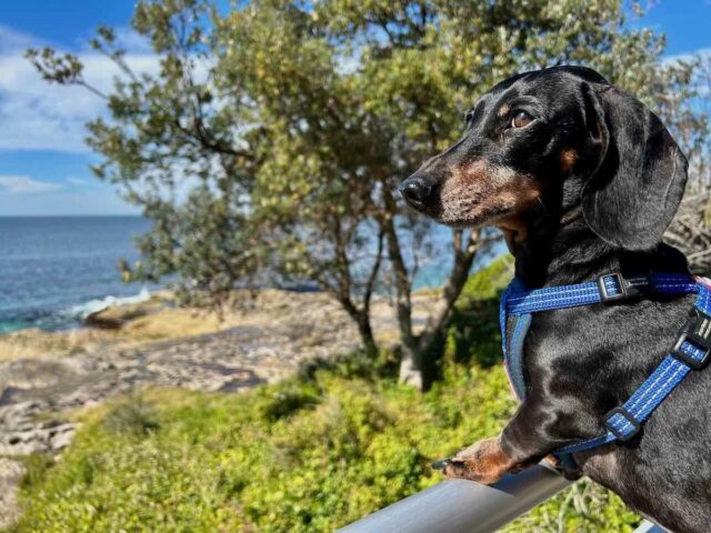
One of my favourite dog-friendly walks in southern Sydney is the scenic walk around the Cronulla Peninsula, known as the Cronulla Beach Walk. This shared walkway starts at the Wanda Beach Surf Life Saving Club near Greenhills Beach and then continues south past the centre of Cronulla to Bass and Flinders Point, the entrance of Port Hacking.
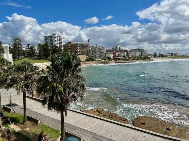
The entire path is about 4.5km long, or 9km return, but it’s also possible to just walk a shorter section. On my most recent visit I parked with my dog at the southern end and then walked north along the cliffs of the peninsula to Cronulla Park, about a 2.4km stretch. Parking is often easiest along this stretch on sunny days, with access to the path from multiple streets.
Along the walk, there are multiple parks where dogs are allowed on-leash (but not off-leash), including Cronulla Park, Shelly Park and Oak Park. If you’d like to mix up your return route, detour over to the other side of the peninsula and walk partially through Gunnamatta Park.
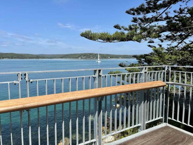
A great new extension to the walk is the Hungry Point Cliff Top Walk. From Bass and Flinders Point, follow footpath through Salmon Haul Reserve to the start of the new 250m-long boardwalk. The walkway hugs the cliffs and has a viewing platform with terrific views at the end. It’s also possible to access the boardwalk from the carpark at end of Nicholson Parade.
#2 The Needles Walk, Engadine
Distance: 1.5km return
Difficulty: Easy-moderate (Easy but steep paved road)
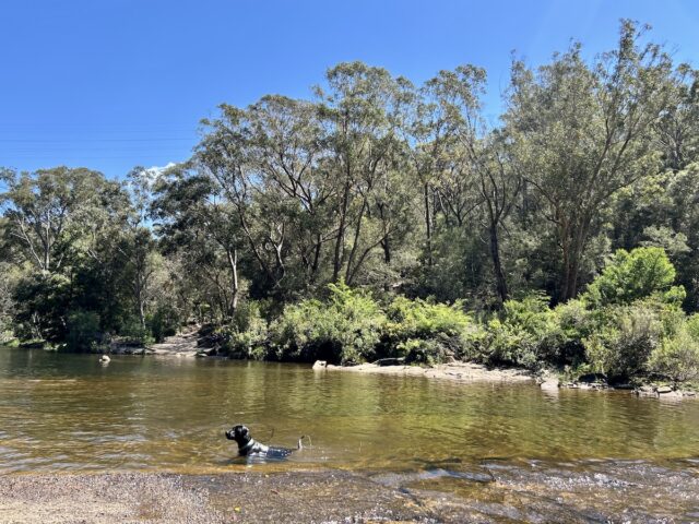
In addition to multiple dog-friendly beaches, there’s some great other dog-friendly swimming spots in southern Sydney along its rivers. One of the most popular dog-friendly swimming holes is The Needles in Engadine.
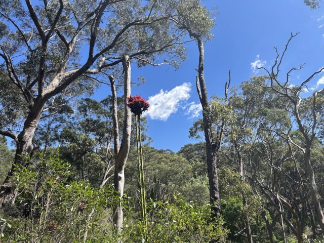
The Needles is reached by a short but steep at times walk down Woronora Road, in between eucalypt trees and towering Gymea lilies. The old road is closed after the junction with Mount Carmel Place, with room for a handful of cars to park at the intersection. The narrow road is still paved and an easy walk, but only used by waterboard vehicles to maintain the pipeline in the area.
The Needles is the swimming hole at the bottom of the hill where the road crossed the Woronora River. When I visited, there was enough water crossing the causeway to necessitate removing your shoes (if you weren’t wearing thongs). Access the water from the causeway or from the beaches on the opposite bank.
Note that there is a sign at the start of the walk sharing that the walk is in a “Koala Zone” – consider whether you’re happy to walk your dog in the area. If you do, always keep your dog leashed, including in the water with a long leash.
#3 Engadine Lagoon Trail, Engadine
Distance: 2.4km return
Difficulty: Moderate (Gravel fire trail and bush track)
While The Needles is a great swimming spot, the walk down to it isn’t the most interesting walk and the swimming hole can be busy on sunny weekends or during school holidays. For a different walk with a swimming hole at the end instead walk to Engadine Lagoon.
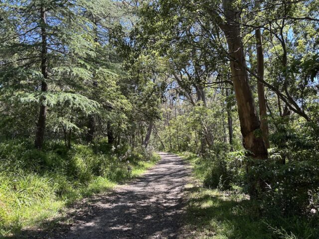
The walking track starts at the same location, but after about 150m turn left onto the Waterboard Road. Continue along the fairly level gravel track, a pretty walk through the trees, for a few hundred metres. At the next junction, take the right hand turn onto the Engadine Lagoon Trail, a rougher stony or sandy track that has some ascents and descents.
Once you reach the turning point, take the bush track on the opposite side. It’s only about another hundred metres to the lagoon, but the track is rougher here, especially after the cliff section – I’m not sure if there’s only one track down to the water. Consider stopping at the cliff if you have a less agile dog, or be prepared to help them.
At the river here, entry to the water is from rocky ledges, not as easy for dogs. I believe there’s a beach if you continue onto the right. Otherwise, it’s a lovely quiet spot surrounded by bush to relax on the rocky boulders.
According to this report, you could also previously walk between The Needles and Engadine Lagoon, but it’s now just “bushbashing”. I didn’t check out the smaller lagoon nearby.
#4 Salt Pan Creek Loop, Padstow
Distance: 5.5km
Difficulty: Easy (Mainly boardwalk or paved, flat)
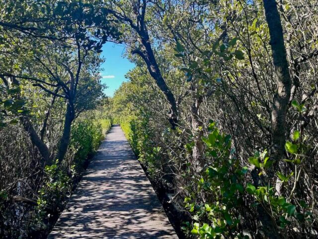
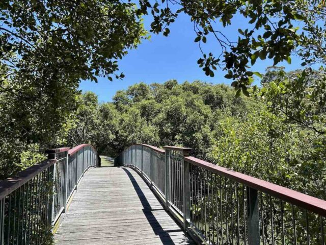
It’s still possible for pockets of nature to still co-exist surrounded by suburbia. A great example of this are the mangroves of Salt Pan Creek in between Riverwood and Padstow. Despite the noise of the M5 motorway, it’s still possible to hear birds tweeting and dragonflies buzzing down below in the mangroves.
There are stretches of boardwalk that run through the mangroves along both banks of sides of Salt Pan Creek, in between the M5 motorway and the train line, that can be joined together to form a long dog-friendly walk. A good starting place is Stuart Street Reserve in Padstow, but you can also park alongside Riverwood Park.
From the northern end of Stuart Street Reserve, turn left and follow the boardwalks north underneath the motorway. Turn almost immediately right, then at the paved path on the other side turn right again.
At Salt Pan Creek Reserve the path splits. I incorrectly took the gravel path alongside the creek, but it’s better to take the paved path to the left. When you get to Riverwood Public School, cut through the grass next to the fence to Union Street then walk along this street to Riverwood Park.
At Riverwood Park, it’s possible to deviate to the Mary Street Dog Park, a quiet fenced off-leash park hidden behind the houses on Mary Street – access it from the end of Coleridge Street. Alternatively, cut across the fields, then there’s a dirt path behind the middle goal post taking you to the paved path that starts at Bennett Lane and runs parallel to William Street.
Passing through this long skinny reserve known as the Riverwood Wetlands, at the end continue onto the Riverwood Boardwalk. Soon after, there is a bridge across the creek, just before the train line. Turn right to follow the mixture of shared path and boardwalks back to Stuart Street Reserve.
Dogs need to be kept on leash throughout the whole walk – some parts are wildlife protection areas. It’s best skipped immediately after heavy rain, when some parts of the boardwalk may flood.
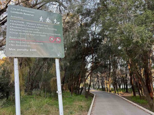
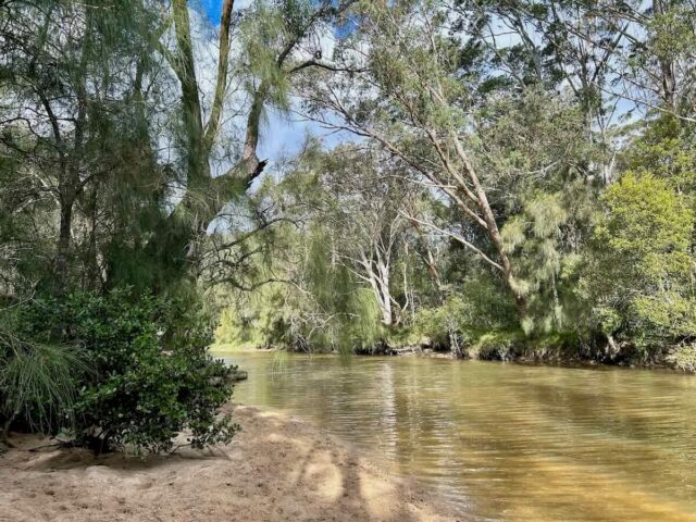
#5 Lambeth Reserve Boardwalk, Picnic Point
Distance: 2km return
Difficulty: Easy (Flat walk, mainly boardwalk)
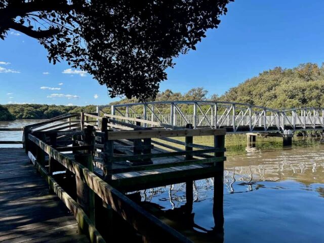
Another great dog-friendly walk in southern Sydney that is mainly along a boardwalk is the Lambeth Reserve Boardwalk. This short but lovely dog-friendly walk starts at Lambeth Reserve in Picnic Point, where leashed dogs are allowed unlike the nearby Georges River National Park.
There’s a decent size carpark at Lambeth Reserve but it’s often full with picnickers in the middle of the day on sunny weekends – instead head there early or late in the day for a walk with your dog along this walking path.
The first third of the track is a recently constructed boardwalk that cuts through she-oak woodlands, also passing a little beach where dogs can enjoy a paddle. Next up is an old wooden boardwalk that perches above the river’s edges, with some great river views, especially at sunset.
The final section is a wide dirt track that ends at Carinya Road. It’s possible to walk further along the grass embarkment to Fitzpatrick Park and the start of the national park. Alternatively, simply turn around at this point and retrace your footsteps. Thanks to being largely boardwalk, it’s still a mud-free walk after rain, although skip it if the river floods.
#6 Oatley Park and Lime Kiln Bay Circuit
Distance: 6km loop
Difficulty: Moderate (Mixture of bush tracks and paved paths, mainly flat)
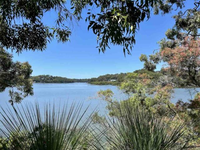
Further down the Georges River you’ll arrive at Oatley Park. Together with the adjacent Lime Kiln Bay area, it’s home to one of the best bushland remnants in this part of Sydney. There’s a number of tracks you can follow both within Oatley Park and around Lime Kiln Bay, but for a decent bushwalk combine both together for this circuit.
Starting from Waterfall Road (alternatively start from one of the carparks in Oatley Park), the track passes through dry eucalypt forest, dotted with grass trees and sandstone outcrops, above the artificially-formed wetland. Popping out onto the edge of a golf course, there’s a stretch of boardwalk alongside the mangroves before you cross a bridge into Oatley Park.
The route follows an asphalt road now closed to cars, but popular with cyclists. Look out for the turn-off to the Headland Track. Information about the local fauna at eight marked points along this scenic track is provided in this brochure. There’s a steep but worthwhile detour up to the “Dracula’s Canteen” overhang at point four.
At the other end of the Headland Track is Oatley Park Baths. Dogs are allowed on the adjacent path but not in the water. Continue along the edge of Jew Fish Bay before heading up to the centre of the park. Be careful on the shared roadway that loops around the playground, before continuing back past the wetlands to your starting point.
Keep an eye on a map most of the way – there’s a lot of branches and no signs. It’s also possible to follow a short section of this walk, whether the loop only around Lime Kiln Bay (about 2.4km long) or the 1.3km long Headland Track, that also visits the “Castle”. Note that the gates to Oatley Park close overnight.
#7 Prince Edward Park Loop, Woronora
Distance: 4km loop
Difficulty: Moderate (Mixture of paved paths and bush tracks)
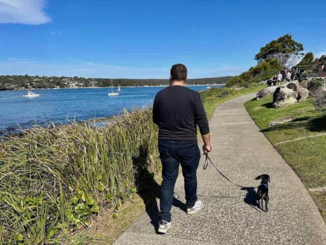
The sleepy suburb of Woronora is tucked away along the banks of the Woronora River to the north, underneath busier Sutherland. It’s possible to drive down to the river here, taking the Menai Road turn-off from River Road and its towering bridge. But it’s also possible to hike down.
Start this track from next to Sutherland Oval, along The Grand Parade. There’s a couple of routes you can take to descend down to the riverside Prince Edward Park, mainly along paved footpaths. I did note a sign at the bottom of the hill that indicates this is also a “koala zone”, so strictly keep your dog leashed and away from any koalas.

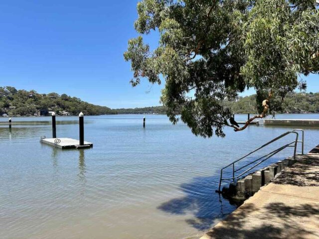
At Prince Edward Park, walk along the grass then along the fairly new path. There’s a swimming spot here for the warmer months and it’s a great spot for a picnic. Alternatively, head across the river to The Boatshed Woronora. Dogs are welcome on the deck at this excellent cafe, plus in the hire craft.

To ascend back up, take the path back up past the RSL club. This section is a bushwalk, that can be muddy at times. At first the path follows the banks of Forbes Creek, where there’s some ideal beaches for a dog paddle.
The track that ascends up the hill and then partially follows the boundary of the large cemetery back to your starting point – it’s best to use a map to monitor your route. Take the branch to visit a lookout point with a seat with views back over the river.
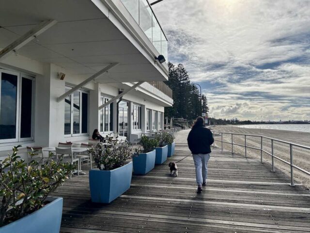
#8 Brighton-Le-Sands Foreshore Walk, Kyeemagh
Distance: Up to 8km one-way
Difficulty: Easy (Flat paved path)
If you’d prefer an easy-to-follow, fully paved path along the waterfront, another great dog-friendly option is the Brighton-Le-Sands Foreshore Walk. Following the edge of Botany Bay, the long shared pathway stretches all the way from the Cooks River to the Georges River, passing through multiple bayside suburbs including Brighton-Le-Sands.
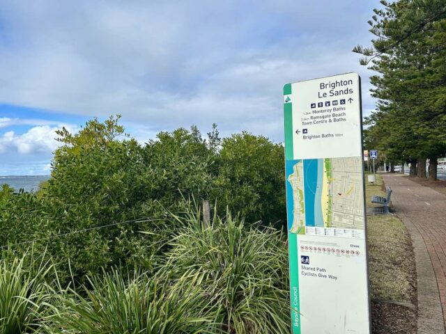
I recommend starting your walk at the northern end, next to the off-leash Kyeemagh Dog Beach, where there’s a convenient large carpark with three hours free parking. Then head south on the shared path along the waterfront.
In Brighton-Le-Sands, detour onto the promenade right next to the sand. The waterfront Brighton Kiosk has plenty of outdoor tables and a water bowl for pups – a convenient spot to stop for a coffee. There is also an interesting memorial to the First Fleet nearby.
About 2km from the starting point, consider turning around here for a shorter walk. Otherwise, the shared pathway continues for another 6km. There’s plenty of signs along the way, along with other facilities including water fountains.
Note that after the initial off-leash dog beach, dogs are not allowed on any other beaches along the route. Always keep your dog leashed, especially along the sections close to the busy road. A short leash is best, so that you can also keep clear of cyclists who share the path.
You May Also Like
- Dog-Friendly Cronulla
- Top Dog-Friendly Walks in the Eastern Suburbs
- Top Dog-Friendly Walks near Wollongong
About the Author

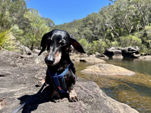
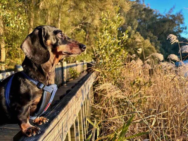
Shandos Cleaver is the founder of Travelnuity: Dog-Friendly Travel. She has travelled extensively with her Miniature Dachshund, Schnitzel, including to 33 countries across Europe, every state and territory of Australia except Tasmania, and 10 of the United States. She’s passionate about providing inspiration and information to others wanting to travel with their dogs, whether close to home or internationally.